
Kearney Under Extreme Heat Warning Through Thursday
/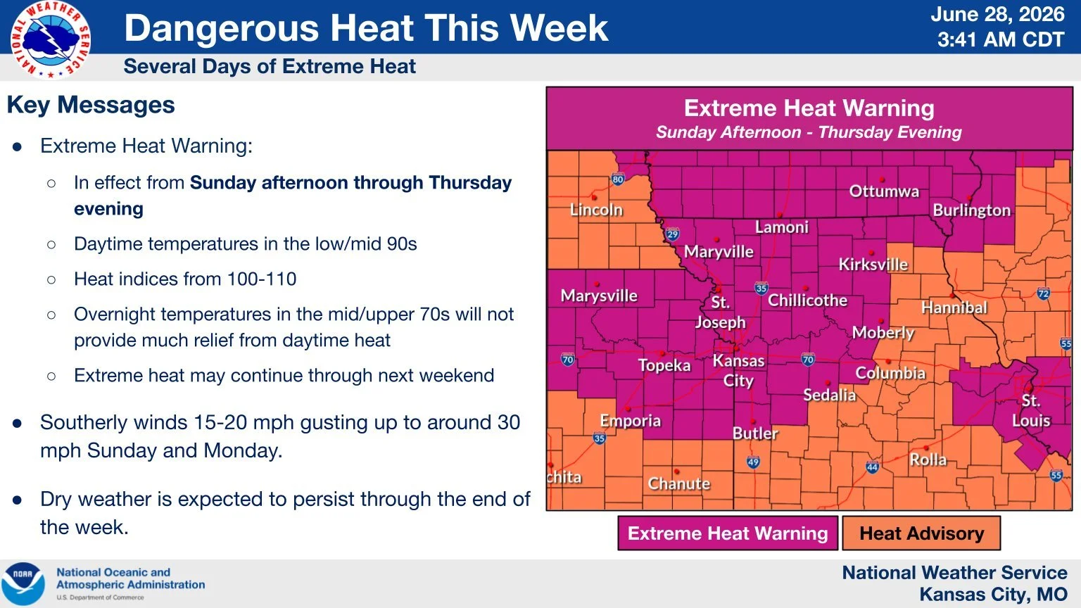
A prolonged stretch of dangerous heat has prompted the National Weather Service to keep an Extreme Heat Warning in effect Kearney and surrounding parts of Kansas and Missouri until midnight Thursday night.
Forecasters expect heat index values to climb as high as 105 to 110 degrees each afternoon, creating potentially dangerous conditions for anyone spending time outdoors or living without reliable air conditioning. The warning also covers portions of east central and northeast Kansas, as well as central, north central, northeast, northwest and west central Missouri.
The concern is not only the intensity of the afternoon heat, but also how long it is expected to last. Overnight temperatures are forecast to remain above 75 degrees in many areas, limiting the chance for homes, roads and people to cool down before another day of extreme heat begins.
Warm nights can be especially dangerous for people without sufficient air conditioning. When temperatures and humidity stay high after sunset, opening windows may not provide enough relief, and indoor spaces can remain dangerously hot for extended periods.
Health officials warn that heat-related illnesses become significantly more likely during extended periods of extreme heat and high humidity. Older adults, young children, people with chronic health conditions, outdoor workers and anyone exercising outside face increased risk.
Residents are urged to drink plenty of fluids, stay in air-conditioned spaces when possible, avoid direct sun and limit strenuous outdoor activity during the hottest part of the day. People are also encouraged to check on relatives, neighbors and others who may be vulnerable or may not have access to cooling.
Officials also stress that children and pets should never be left unattended in vehicles. Car interiors can reach lethal temperatures within minutes, even during short stops.
KPGZ News – Brian Watts contributed to this story.